Start the conversation
Contact us today to see how you could benefit from our services, technology and marine expertise


A New Generation of Coastal Water Level Monitoring
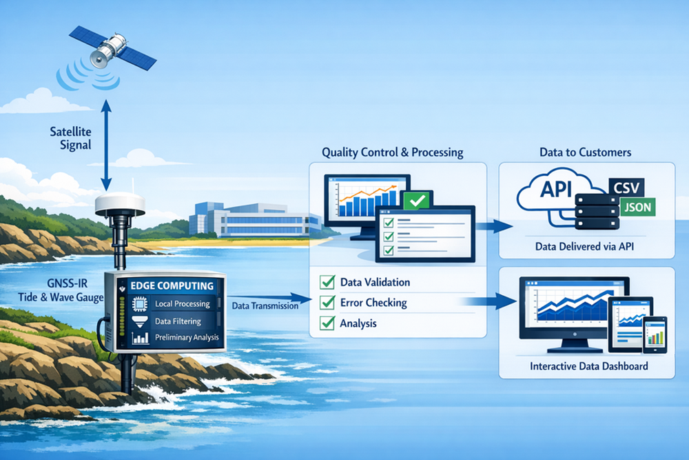
NOC Innovations is developing a GNSS-IR (Global Navigation Satellite System Interferometric Reflectometry) coastal monitoring service that will provide high-quality sea level observations using satellite navigation signals and low-cost shore-based sensors.
This emerging capability offers a complementary approach to traditional tide gauges, enabling organisations to monitor coastal water levels with reduced infrastructure requirements and increased deployment flexibility.
GNSS-IR uses reflected signals from satellite navigation systems, such as GPS and Galileo, to measure the height of the sea surface relative to a fixed receiver located near the coast.
By analysing the interference between direct and reflected satellite signals, GNSS-IR can generate precise water level measurements suitable for a wide range of coastal applications.
The service is being developed to support organisations involved in:
Key benefits include:
NOC Innovations is currently working with the National Oceanography Centre's scientists and engineers to translate leading GNSS-IR research into operational monitoring services.
Future service offerings may include:
We are currently engaging with ports, coastal authorities, infrastructure operators, environmental organisations and commercial partners interested in next-generation coastal monitoring solutions.
To register your interest or discuss potential pilot opportunities, please contact:
NOC Innovations
Email: business@noc.ac.uk
This emerging capability provides a flexible, low-infrastructure complement to traditional tide gauges, enabling organisations to monitor coastal water levels more efficiently.
Layton Quinton
Head of Commercial Software and Data
